Bhutan, Beyond the Ordinary

Himalayan Discovery: An Insider Journey Through Bhutan’s Sacred Valleys

Most visitors assume Bhutan is defined only by its monasteries, but travelers quickly realize that life here unfolds in the transitions between valleys. Crossing from Thimphu’s forested ridges down into Punakha’s subtropical river basin brings a dramatic shift in altitude, architecture, and temperature within a two-hour drive.

This 6-night circuit covers Western Bhutan’s core cultural spine without unnecessary rush. You will navigate winding high-pass roads, walk through farmhouse hamlets where prayer flags rustle over tiered paddy fields, and complete the iconic pilgrimage to Paro Taktsang before departing.
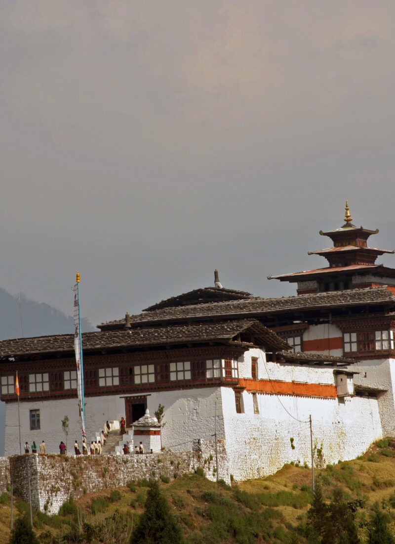
Dochula Pass (3,100 m): 108 memorial chortens facing an unbroken panoramic ridge of the eastern Himalayas on clear mornings. Punakha Dzong (Punakha): Built at the confluence of the Pho Chhu and Mo Chhu rivers; widely considered the pinnacle of 17th-century Bhutanese fortress architecture. Paro Taktsang (Tiger’s Nest, Paro): A cliffside sanctuary anchored 900 meters above the valley floor where Guru Padmasambhava meditated in the 8th century. Centenary Farmers Market (Thimphu): The pulse of weekly local commerce, where foragers bring wild fiddlehead ferns, dried yak cheese (chhurpi), and native red chillies from across the districts.
Distance
55 km
Travel Duration
1.5 hours
Min Altitude
2,200 m
Max Altitude
2,334 m

Valley Entry and First Impressions

The descent into Paro Valley offers an immediate look at traditional rammed-earth farmhouses scattered across rice terraces. After meeting your local guide at the airport, follow the Pa Chhu river down to its confluence with the Wang Chhu, climbing gently into the capital city of Thimphu.

Spend the late afternoon walking through Norzin Lam. Locals gather here before sunset, and the absence of traffic lights gives the city its distinct, unhurried rhythm.

Distance
30 km
Travel Duration
1 hour
Min Altitude
2,300 m
Max Altitude
2,600 m

Living Heritage & Valley Sanctuaries

Begin at the National Memorial Chorten, where elderly residents circumambulate the shrine through the morning mist spinning handheld prayer wheels. Drive up to the ridge at Kuensel Phodrang to view the 51.5-meter bronze Buddha Dordenma looking across the entire valley floor.

In the afternoon, visit the National Institute for Zorig Chusum to observe apprentices training in Bhutan’s 13 traditional crafts, followed by an evening walk around Tashichho Dzong, the seat of the government and the central monastic body.

Distance
74 km
Travel Duration
2.5 to 3 hours
Min Altitude
1,242 m
Max Altitude
3,100 m

Across the Cloud Forest to the Low Valleys

The climb toward Dochula Pass (3,100 m) cuts through dense forests of hemlock, fir, and seasonal rhododendrons. At the pass, 108 Druk Wangyal Chortens stand against the backdrop of snow-capped northern peaks like Gangkar Puensum on clear mornings.

Descend over 1,700 vertical meters into the warmer, semi-tropical valley of Punakha. Take a gentle 30-minute walk through the village of Sopsokha across terraced fields to Chimi Lhakhang, the fertility temple dedicated to Drukpa Kunley.

Distance
25 km
Travel Duration
45 minutes
Min Altitude
1,240 m
Max Altitude
1,500 m

Riverside Heritage & Valley Footpaths

Spend the morning at Punakha Dzong, situated at the junction of the Pho Chhu (father) and Mo Chhu (mother) rivers. Its whitewashed walls and woodwork served as Bhutan’s seat of government until the mid-1950s.

Cross the 160-meter Punakha Suspension Bridge—one of the longest in the country—hung with prayer flags above the swift river. Later in the afternoon, take an easy 45-minute hike up through pine groves to Khamsum Yulley Namgyal Chorten for a view over the Mo Chhu valley floor.

Distance
125 km
Travel Duration
3.5 to 4 hours
Min Altitude
1,242 m
Max Altitude
3,100 m

Return West & Ancient Strongholds

Retrace the highway back over Dochula Pass and drop into the Paro Valley. Once in Paro, visit the National Museum (Ta Dzong), housed in a circular watchtower built in 1649 that stores thangkas, weaponry, and cultural artifacts.

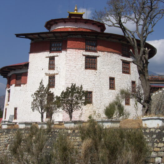
Walk down the cobblestone footpath to Rinpung Dzong (“Fortress of the Heap of Jewels”), which overlooks the traditional wooden cantilever bridge spanning the Paro Chhu.

Drukgyel Dzong Feature Image

The Drukgyel Dzong overlooks the beautiful Phondey village with Mount Jomolhari in the background. This Dzong (Fortress) was built in 1646 by  Zhabdrung Ngawang to commemorate his victory over the Tibetan invaders led by Mongolion warlord, Gushri Khan. The ancient fortress served as an important defense base in the region…

Distance
6.5 km
Travel Duration
5 to 6 hours
Min Altitude
2,200 m
Max Altitude
3,120 m

The Pilgrimage Trail

Start early from the valley base (2,600 m) to beat the mid-day heat. The trail climbs through blue pine and oak forests draped in Spanish moss, opening at a mid-way cafeteria where you get your first view of the monastery anchored to the granite cliff face.

The final approach leads across a waterfall gorge before ascending the stone steps into the monastery complex at 3,120 meters. Inside, butter lamps illuminate the rock-carved meditation caves of Guru Rinpoche. Head down in the afternoon and enjoy a traditional hot stone bath at a local farmhouse.

Distance
5 km
Travel Duration
15 minutes
Min Altitude
2,200 m
Max Altitude
2,200 m

Enjoy an early breakfast at the hotel before driving to Paro International Airport (PBH) for your departure flight back through the Himalayan corridor.

Essential Bhutan Himalayan Explorer: Valleys of Paro, Thimphu & Punakha

5 Nights / 6 Days

Discover More
Himalayan Escape

11 Nights / 12 Days

Discover More
Night Wonders of Bhutan: The Classic Valley Highway

04 Nights/ 5 Days

Discover More
Enquire