Bhutan, Beyond the Ordinary

Himalayan Escape

Travelers often arrive expecting an isolated museum piece, but they quickly realize Bhutan is an active, breathing way of life. Roads curve along raw cliff faces, prayer flags crackle under high-altitude winds, and everyday life moves to the cadence of seasonal farm work and monastic chants.

This 12-day journey follows the ancient east-west artery across seven distinct valleys. You will move from the vibrant administrative center of Thimphu, across the subtropical farmsteads of Punakha, past the glacial wetlands of Phobjikha, and deep into Bumthang—the spiritual cradle of the Kingdom. It is built for curious travelers who want to trade scripted tourist stops for actual conversations with local monks, tea with village elders, and quiet ridge walks across high Himalayan passes.
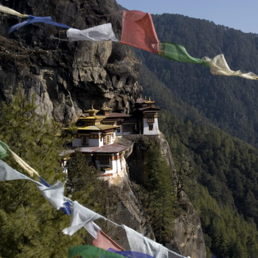
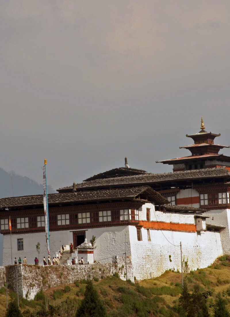
Taktsang Goemba (Tiger’s Nest), Paro: Clinging to a 900-meter sheer cliff face where Guru Rinpoche meditated in the 8th century. Punakha Dzong, Punakha: The 17th-century "Palace of Great Happiness," built at the confluence of the Pho Chhu and Mo Chhu rivers. Phobjikha Conservation Area: A glacial valley sitting at 2,900m, winter nesting sanctuary for rare Black-necked Cranes. Yotong La (3,425m) & Chele La (3,980m): High Himalayan mountain passes hung with prayer flags overlooking Mount Jomolhari. Ogyen Choling Palace, Tang Valley: A restored 16th-century ancestral manor house displaying authentic rural Bhutanese heritage.
Distance
55 km
Travel Duration
1.5 hours
Min Altitude
2,280 m
Max Altitude
2,320 m

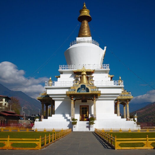
Touch down on the airstrip squeezed between 5,000-meter peaks. Meet your local guide and driver, then follow the Paro Chhu river downstream along the winding highway to Thimphu. Spend the late afternoon adjusting to the altitude, taking a quiet walk around the National Memorial Chorten alongside local residents circumambulating the stupa.

Paro Bazaar Feature Image

Rows of shops line the main Paro Bazaar built in traditional architecture. This stretch of about 250 meters, houses many different types of shops from handicrafts to restaurant. Of late some coffee houses and local restaurants has also sprung up. Paro Bazaar is a good place to meet locals and…

National Memorial Chorten Feature Image

Constructed in 1974 in memory of the Third King of Bhutan, Jigme Dorji Wangchuck, this Tibetan-style stupa stands at the spiritual heart of downtown Thimphu. Unlike classical chortens that enshrine human relics, this monument represents the mind of the Buddha, topped with a golden finial and adorned with intricate wood…

Distance
30 km
Travel Duration
3–4 hours total drivin
Min Altitude
2,320 m
Max Altitude
2,650 m

Thimphu remains the only capital city in the world without traffic lights. Field notes from local guides recommend starting early at the Buddha Dordenma to catch the morning fog lifting off the valley floor. Visit traditional papermaking workshops and the National Institute for Zorig Chusum, where students train for years in Bhutan’s 13 traditional arts.

Buddha Dordenma (Buddha Point) Feature Image

Rising 51.5 meters above the valley floor at Kuensel Phodrang, this colossal bronze and gilded statue of Shakyamuni Buddha anchors the southern skyline of Thimphu. Built to fulfill an ancient prophecy of peace and global harmony, the massive exterior conceals a grand three-story temple hall housing 125,000 smaller bronze Buddha…

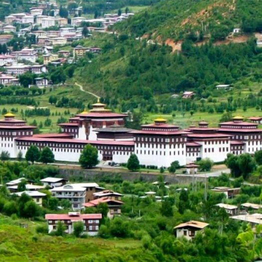
Tashichho Dzong (Fortress of the Glorious Religion) Feature Image

Positioned on the banks of the Wang Chhu river, this 13th-century fortress serves as the seat of the Royal Government of Bhutan and the summer residence of the Je Khenpo (Chief Abbot) and the Central Monastic Body. Reconstructed in traditional fashion in 1962 without iron nails or blueprint drawings, the…

Distance
75 km
Travel Duration
3 hours
Min Altitude
1,300 m
Max Altitude
3,100 m

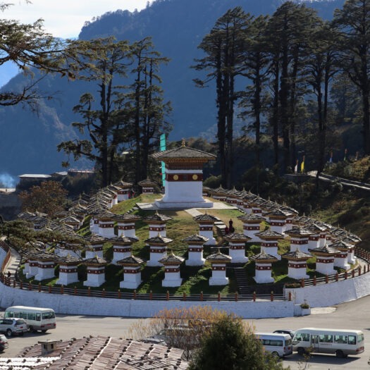
Ascend through mist-draped pine forests to Dochula Pass, marked by 108 memorial stupas. On clear days, the snow-capped Eastern Himalayas dominate the northern horizon. Descend dramatically through temperate rain forests into the warm Punakha valley, where citrus orchards replace alpine conifers.

Dochula Pass Feature Image

Perched at an elevation of 3,100 meters along the mountain highway connecting Thimphu to Punakha, Dochula Pass is one of Bhutan’s most iconic and spiritually charged mountain crossings. The crest of the pass is crowned by the 108 Druk Wangyal Chortens, a terraced mandala of whitewashed stupas commissioned in 2004…

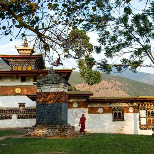
Chimi Lhakhang Feature Image

Perched on a round hillock in the fertile agricultural basin of Sopsokha, Chimi Lhakhang is a 15th-century sanctuary founded by Ngawang Chogyal and sanctified by the eccentric saint Drukpa Kunley, famously known as the "Divine Madman." Renowned throughout the region as a fertility temple, it attracts couples from across Bhutan…

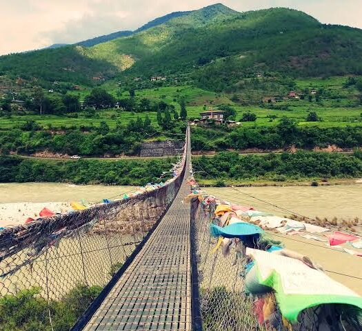
Punakha Suspension Bridge Feature Image

Stretching approximately 160 meters across the rushing waters of the Pho Chhu river, the Punakha Suspension Bridge is one of the longest pedestrian suspension bridges in Bhutan. Originally constructed to link Punakha Dzong with the outlying farming villages of Shengana, Samdingkha, and Wangkha, the metal-cable span is festooned from end…

Distance
25 km
Travel Duration
2 hours driving, 2.5 hours hiking
Min Altitude
1,300 m
Max Altitude
1,550 m

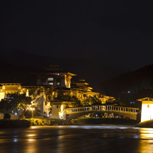
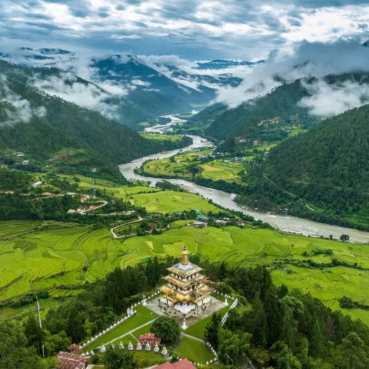
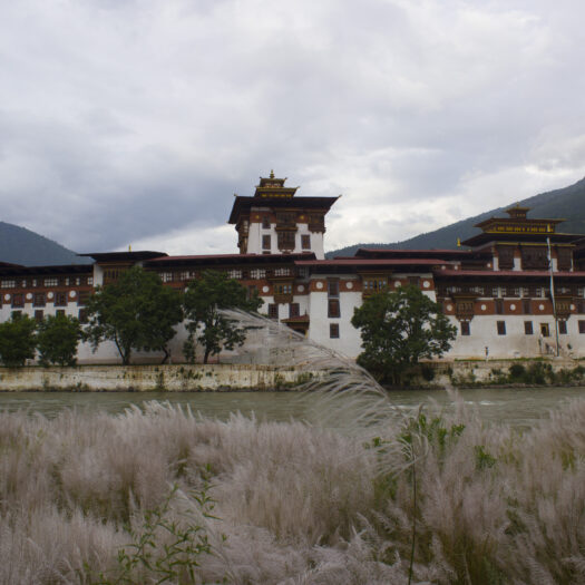
Morning visit to Punakha Dzong, situated at the exact point where the Pho Chhu (Male) and Mo Chhu (Female) rivers meet. Afterwards, cross a footbridge to hike up through terraced fields to Khamsum Yulley Namgyal Chorten, built by the Queen Mother for world peace.

Punakha Dzong (Pungtang Dechen Photrang) Feature Image

Commanding the junction where the Pho Chhu (father) and Mo Chhu (mother) rivers meet, Punakha Dzong is widely regarded as the pinnacle of classical Bhutanese fortress architecture. Constructed in 1637 by Zhabdrung Ngawang Namgyal, this massive citadel served as Bhutan’s seat of government until the mid-20th century and remains the…

Khamsum Yulley Namgyal Chorten Feature Image

Anchoring a high northern ridge above the Mo Chhu river, Khamsum Yulley Namgyal Chorten was built over an eight-and-a-half-year period by Her Majesty Queen Mother Ashi Tshering Yangdon Wangchuck. Consecrated in 1999 to ward off negative forces and foster world peace, this four-story pagoda-style stupa is an extraordinary showcase of…

Distance
78 km
Travel Duration
3 hours
Min Altitude
1,300 m
Max Altitude
3,120 m

Climb out of the warm valleys toward the high plateau of Gangtey/Phobjikha. This broad, tree-less U-shaped glacial valley feels entirely distinct from western Bhutan. Visit Gangtey Goemba, a 17th-century Nyingmapa monastery overlooking the wetlands, before walking the Gangtey Nature Trail through dwarf bamboo forests.

Gangtey Monastery Feature Image
Wangdue Phodrang

Built in the 17th century by Je Kuenga Gyaltshen, the Gangtey Goemba is located in Phobjikha valley (East of Wangdi). The monastery sits on a hilltop at an altitude of 2800 meters and commands a mesmerizing view of phobjika valley.

Gangtey Nature Walk Feature Image

This pleasurable walk will give you a nice feeling for Phobjikha Valley. From the small hilltop overlooking Gangtey Goemba, you head downhill through flower meadows to Simchubara Village and from here through beautiful forest and into the open valley. After passing a Chorten and Khewa Lhakhang, the trail ends at…

Distance
120 km
Travel Duration
4.5 hours
Min Altitude
2,200 m
Max Altitude
3,420 m

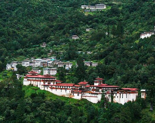
Traverse Pele La pass, the traditional boundary between western and central Bhutan. Watch the vegetation shift to dwarf bamboo and rhododendron. Arrive in Trongsa, an impressive mountain fortress settlement built directly on a gorge edge that historically controlled all east-west trade across the Kingdom.

Chendebji Chorten Feature Image

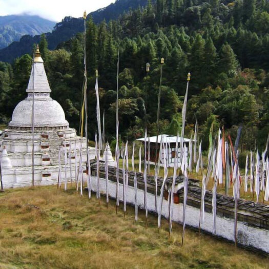
Situated along the western highway approach to Trongsa near the village of Chendebji, this historic stupa was constructed in the 18th century by Lama Shida, patterned after the famous round-domed Boudhanath stupa of Kathmandu. Built at a strategic river confluence, local lore holds that the monument was established to pin…

Trongsa Dzong (Choekhor Rabtentse Dzong) Feature Image

Perched dramatically on a narrow mountain spur above the deep gorge of the Mangde Chhu river, Trongsa Dzong is the largest fortress in Bhutan and the historic cradle of the Wangchuck dynasty. Founded in 1543 by Drukpa Lama Ngagi Wangchuck and expanded in 1647 by Zhabdrung Ngawang Namgyal, this massive…

Ta Dzong (The Tower of Trongsa Heritage Museum) Feature Image

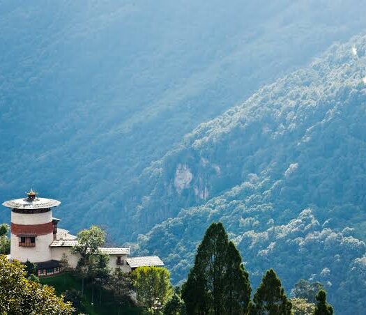
Standing high on the mountain ridge directly above Trongsa Dzong, this circular 17th-century stone watchtower was constructed in 1652 by Chogyal Minjur Tenpa to defend the fortress against inland threats. Today, the five-story defensive tower has been meticulously converted into a state-of-the-art museum, showcasing the history of the Wangchuck dynasty,…

Distance
68 km
Travel Duration
2.5 hours
Min Altitude
2,200 m
Max Altitude
3,425 m

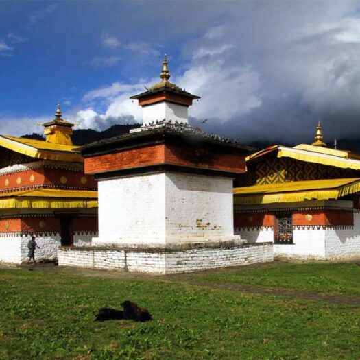
A scenic drive over Yotong La pass (3,425m) brings you into the sacred Choekhor Valley in Bumthang. Known locally as the “Switzerland of Bhutan,” the landscape opens into wide pine-forested valleys dotted with ancient sites. Spend the afternoon visiting Jambay Lhakhang, built in the 7th century by the Tibetan King Songtsen Gampo.

Jambay Lhakhang Feature Image

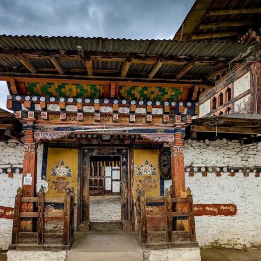
Built in 659 AD by the Tibetan King Songtsen Gampo, Jambay Lhakhang is among the oldest surviving Buddhist sanctuaries in the Himalayas. Established as one of 108 border-taming temples constructed overnight across the Tibetan plateau to pin down an immense mythical demoness, the sanctuary marks her left knee. The inner…

Kurjey Lhakhang Feature Image

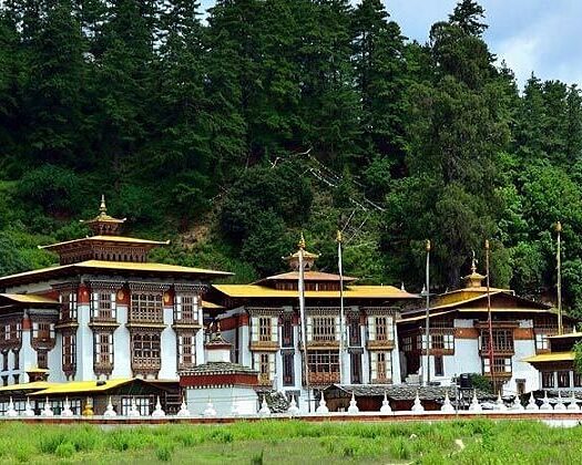
Located on the banks of the Chamkhar Chhu in the Choekhor Valley, Kurjey Lhakhang is one of Bhutan’s most sacred temple complexes. The site comprises three grand temples framed by an imposing wall crowned with 108 miniature chortens. The oldest building, constructed in 1652, is built directly over the rock…

Distance
70 km
Travel Duration
4 hours total driving
Min Altitude
2,600 m
Max Altitude
2,850 m

Leave main roads behind and drive along an unpaved track up Tang Valley, one of Bumthang’s most authentic rural enclaves. Stop at Mebartsho (The Burning Lake), a sacred river gorge site where Pema Lingpa recovered treasure texts in the 15th century. Continue up to Ogyen Choling Manor to learn about historic feudal estate life in Bhutan.

Mebar Tsho (The Burning Lake) Feature Image

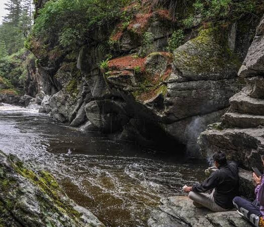
Tucked into the Tang Valley, Mebar Tsho is not a conventional lake, but a deep, sacred water pool carved into a narrow gorge along the Tang Chhu river. The site gained sacred renown in the late 15th century when Terton Pema Lingpa jumped into the swirling waters holding a burning…

Tamshing Lhakhang (Tamshing Lhendrup Chholing) Feature Image

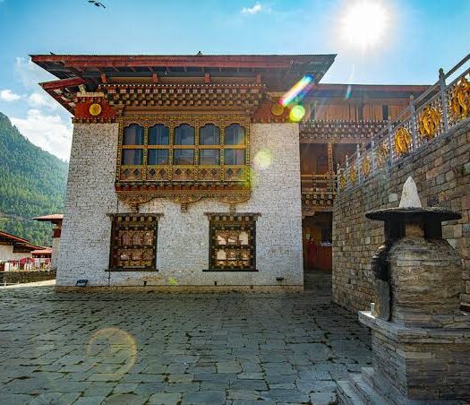
Situated across the river from Kurjey, Tamshing Lhakhang was founded in 1501 by Terton Pema Lingpa, Bhutan’s foremost spiritual treasure revealer and master artisan. The temple holds immense historical and theological importance as the primary seat of the Peling tradition of Himalayan Buddhism. Inside its low-ceilinged, incense-scented shrine rooms are…

Distance
65 km
Travel Duration
35 min flight + 2 hours driving
Min Altitude
2,280 m
Max Altitude
3,980 m

Take a morning domestic flight from Bathpalathang Airport (Bumthang) back to Paro, avoiding two full days of retracing steps by road. Upon arrival, head straight into the high-altitude Haa Valley via Chele La Pass (3,980m), the highest drivable road pass in Bhutan.

Chele La Pass Feature Image

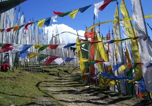
Rising to an altitude of 3,988 meters between the valleys of Paro and Haa, Chele La is the highest motorable road pass in Bhutan. The winding ascent climbs through dense forests of blue pine, giant hemlock, and vibrant rhododendrons before emerging above the treeline into windswept alpine meadows. On clear…

Lhakhang Karpo and Lhakhang Nagpo (White and Black Temples) Feature Image

Nestled at the base of the sacred Meri Puensum (Three Brother Hills), these twin 7th-century sanctuaries are the spiritual heart of the Haa Valley. According to historical tradition, Tibetan King Songtsen Gampo released a white pigeon and a black pigeon to choose the auspicious ground for two temples aimed at…

Distance
65 km
Travel Duration
2 hours
Min Altitude
2,280 m
Max Altitude
2,700 m

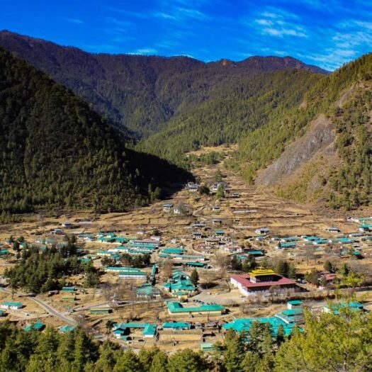
Haa only opened to international visitors in 2002 and maintains a quiet, rural atmosphere dominated by ancestral apple orchards and yak herding trails. Enjoy a morning walking tour through the traditional village of Katsho before taking the scenic lower road back into Paro Valley.

Katsho Village and Farmsteads Feature Image

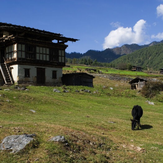
Located just north of the central township, Katsho is a traditional farming village that showcases the authentic, unhurried pace of everyday life in western Bhutan. The village is characterized by grand, two-to-three-story rammed-earth and timber houses featuring intricate hand-painted eaves, open drying attics for winter hay and chillies, and wood-fired…

Bhutanese Farmhouse Visit Feature Image
Paro

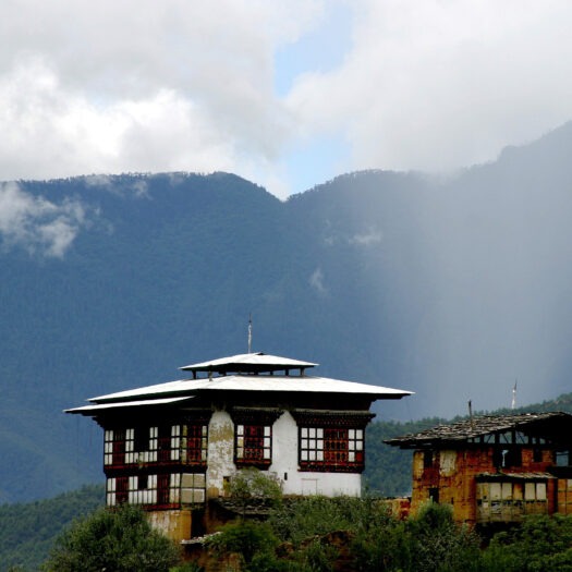
Bhutanese farmhouses are colorful, decorative and traditionally built without any nails. Majority of the houses are with three story, first floor is utilized for sheltering cattle, second floor for the family to live in and the top for storing and drying of foods and fodder for animal. Almost all the…

Distance
10 k
Travel Duration
4 to 6 hours round trip hiking
Min Altitude
2,280 m
Max Altitude
3,120 m

Conclude your journey with Bhutan’s iconic landmark: Taktsang Goemba. Early morning starts are key to beat the heat on the uphill trail. The path switchbacks through shaded pine forests draped in Spanish moss before breaking out at a ridge lookout right across from the cliffside monastery.

Tigersnest Monastery Feature Image

The Taksang monastery is one of the most revered places of pilgrimage in Bhutan. Dedicated to Guru Padmasambhava, this incredible monastery clings to the edge of a sheer rock cliff that plunges 900 meters into the valley below. Legend has it that Guru Padmasambhava, chose a cave on a sheer…

Kyichu Monastery Feature Image
Paro

The Kyichu Monastery is considered to be one of the oldest temples in Bhutan and a popular place of pilgrimage for many Bhutanese. Lore has it that a Tibetan king called Songtsen Gompo built 108 temples in one day and Kyichu Lhakang was one of the them. Is it said…

Distance
10 km
Travel Duration
20 minutes
Min Altitude
2,280 m
Max Altitude
2,280 m

After breakfast at your hotel, your driver and guide will drop you off at Paro International Airport for your outward flight back home.

Essential Bhutan Himalayan Explorer: Valleys of Paro, Thimphu & Punakha

5 Nights / 6 Days

Discover More
Night Wonders of Bhutan: The Classic Valley Highway

04 Nights/ 5 Days

Discover More
Night Bhutan Himalayan Birding Trail: Valleys, Passes & Forest Sanctuaries

7 Nights / 8 Days

Discover More
Enquire